Expertise | Reliability | Innovation
Leading Surveys
With Leading Surveys servicing South East Queensland and beyond, we deliver accurate, reliable land surveys across a wide range of projects. Our expertise covers Contour & Design, Construction & Engineering, UAV/Drone, HP Site Print Automated Robotic Setout and Scanning & Modelling Surveys, along with tailored solutions to suit your project needs.
We’re committed to providing every client with high-quality data, exceptional value, and the benefit of extensive experience across multiple sectors.
Our Services
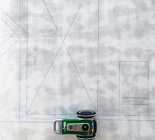
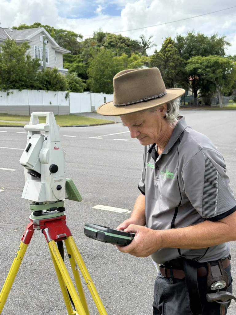
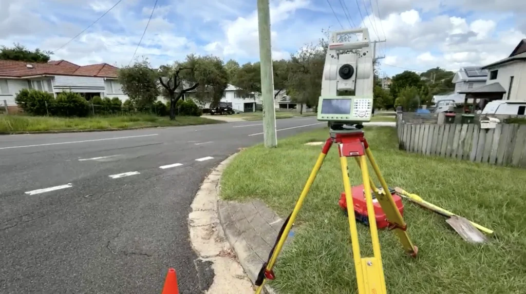
Automatic Robotic Setout
HP SitePrint Certified Service Provider
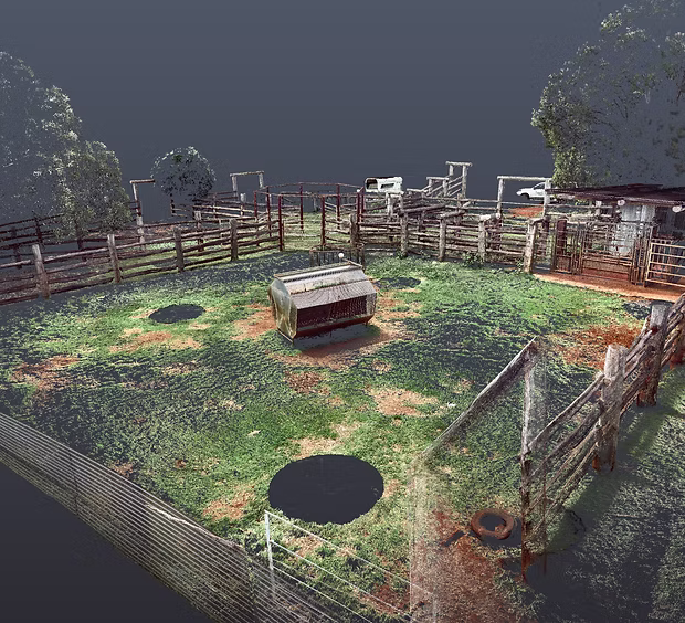
3D Modelling, BIM and Data
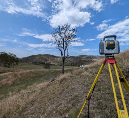
Scanning Services
Machine Control
Control, Calibrations and Data Calculations
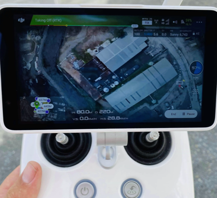
Drone/UAV
Aerial RTK 3D Spatial Surveying and photogrammetry
Cadastral Surveys
Property Boundary, Land Subdivision, Easement
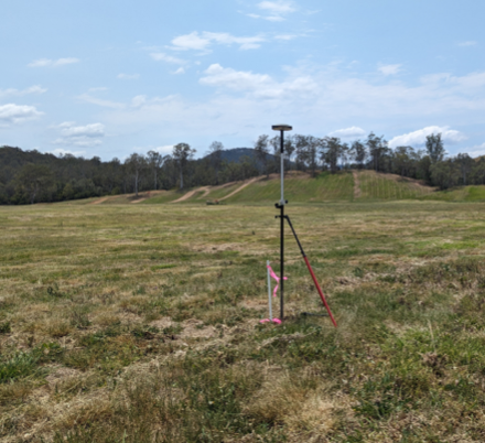
Contour and Detail Surveys
Site, Feature and Topographical
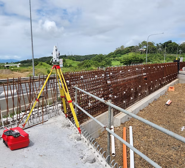
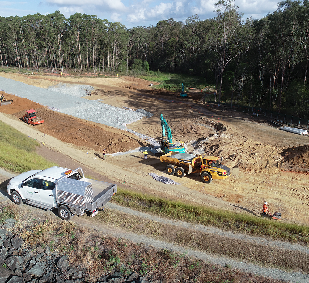
Construction Surveys
Building, Engineering and Civil Setout
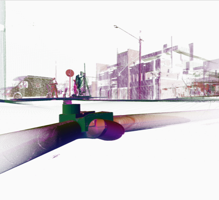
Subsurface Utility Investigation
Underground Infrastructure Identification
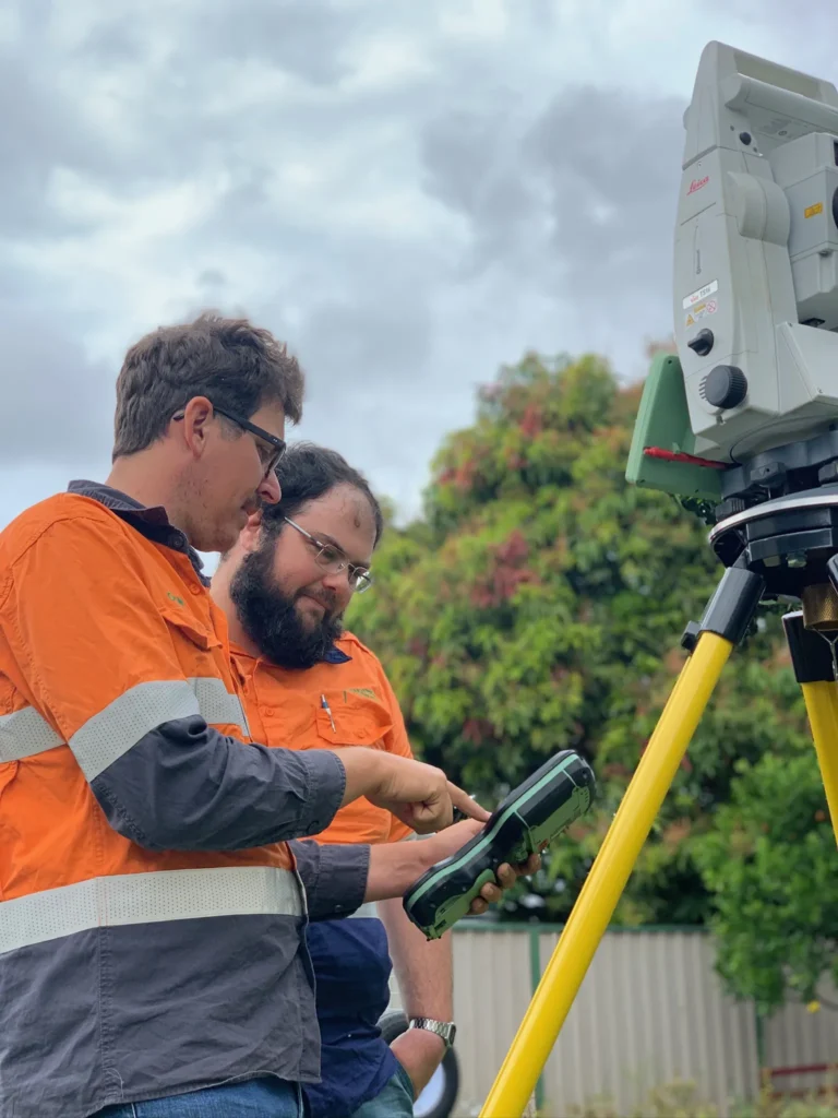
Land Surveyors
Leading Surveys is bringing together specialist surveying expertise, practical advice, and innovative technology solutions to deliver high quality data and insights to keep your project future ready and maximise today’s opportunities with technology. We understand the importance of having your project well managed to meet the milestones and job requirements and will tailor the specific needs to each individual project.
Supporting clients across Australia and Internationally, Leading Surveys is entrusted to deliver leading survey solutions for all projects near and far. From high-rise developments around Brisbane, Sunshine & Gold Coasts, and major hospitals in Sydney, to remote heritage listed stone houses in rural Australia, residential boundary surveys and major mining, roads and water infrastructure projects, our experience spans a diverse range of industries across Australia. Internationally we have delivered projects across South-East Asia in record time using robotic automated construction set-out technology. With strong logistical and technical experience, we help to meet the project verification, construction, and certification requirements to avoid obstacles that can sometimes be overlooked.
Our primary services include, Automated Robotic Setout (HP SitePrint Certified Provider), 3D Modelling, BIM and Data, Machine Control, Drone/Unmanned Aerial Vehicles, Machine Control and Data Calculations for all heavy machinery requiring GPS, Cadastral Surveys (for all property, subdivision, boundary and lease surveying), Contour and Detail Surveys (for construction projects across all industries, and Construction Surveys. Check out more on our services page.
The core strength of our business is our people. Our talented team are well experienced surveyors and are committed to quality results for their projects. With collaboration as a team within the business, we use opportunities to share our skills, knowledge, and workforce to deliver across a broad range of industry and project types with high quality results. If you’re interested in joining our team, visit our current Career Opportunities
Surveyors Australia
When it comes to professional land surveying, precision and accuracy is key to moving a project forward. If you’re searching for reputable surveyors near me, our team at Land Surveys provides high quality data solutions to ensure every project runs smoothly and efficiently.
Every measurement we take, every data set we deliver and every report we produce is checked against the rigorous quality standards our clients depend on. Whether your project is still in the very early stages of the project or getting close to final certification, precise survey data is imperative to keep timelines intact and budgets on track. Our skilled surveyors always go the extra mile to deliver high quality job outcomes including being across every decision, structure and boundary solution – setting the foundation for every project.
Tailored Solutions To Meet Your Needs
Our land surveyors in Brisbane understand that every project is different and comes with its own unique demands. Whether it’s dealing with strict timelines, precisely measured engineering tolerances or complex landscapes, it’s important to have the right surveying company that delivers to your diverse project needs.
Modern construction and development projects are increasingly complex – with regulatory requirements and site conditions that must be met on time and within budget. As experienced surveyors, we have the skill and expertise to capture accurate spatial data that is current, reliable and designed to identify potential issues early. Whether you’re a project manager, site manager or engineer, we collaborate with all members of the project to deliver exceptional results.
Investing In Technology to Produce Better Outcomes
Investing in the latest survey technology is at the heart of what we do. Better tools, advanced equipment and adoption of innovative solutions is what sets us apart from others out there.
The main tools we use include HP SitePrint automated robotic setout, drone-based aerial mapping and advanced BIM integration that extends beyond traditional methods. This means faster coverage, greater attention to detail and seamless support at every stage of your project. Whether it’s a large scale residential multi-development, mining or civil infrastructure project, our skilled land surveyors in Brisbane can manage all your site requirements efficiently.